
15. A tale of two websites
Towards the end of 2006, much of the research from the project started to be available on websites. Unusually, material was published on two separate websites: the Badsey website and a special website set up for us by Worcestershire County Council (WCC).
The WCC website is based on the digitised version of the Enclosure Maps. A GIS system allows this digitised map to be viewed superimposed on a modern OS map making comparisons very easy. Some thematic mapping can also be superimposed.
The project also added several new sections to the Badsey website, the most important being a page for every road and street in the parish, with some information on individual houses.
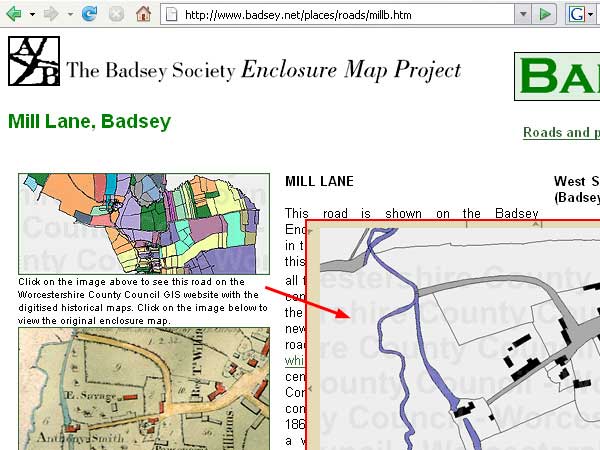
Careful planning allowed these two websites to be linked together in a user friendly way. The illustration above shows part of the Mill Lane page on the Badsey website. A single click opens the GIS system centred on the same road (shown here as an inset). A similar process allows users on the GIS site to move directly to the corresponding page on the Badsey website.