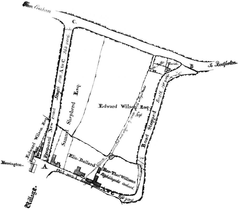
Until 1815 the main road going north out of Badsey followed a contorted route. From the High Street it turned right into what is now Old Post Lane and then left, roughly following the route of the modern footpath, before emerging on the main road between Evesham and Bretforton. In 1815 this was changed by the construction of a 'new road' which extended the High Street north past the Manor House and along what is now called Synehurst.
The change is described in a Magistrates Order dated 1 July 1815 accompanied by the map which is shown below. The order described the old road as "for the greatest part very narrow and greatly out of repair and is at the same time very inconvenient and incommodious for travelers and would be more advantageous to the public to stop up the same and make a new road by which means the distance will be much lessened...". A number of landowners were affected by the change and they are named in the order. Three years earlier the Badsey Enclosure Act had been passed so it must have been a time of considerable change in the village. The new route shortened the journey to Evesham by 420 yards. The old road was 'stopped'. A 'foot road' marked on the map was also closed.
The map is looking north with the B4305 at the top and Old Post Office Lane at the bottom. It marks Harrington House, the Manor House (belonging to Edward Wilson), Oakleigh House as well as other buildings.
We are grateful to the Worcestershire Record Office who have the original map and order (BA1 Midsummer 1815, 110/620 No.46a). Also many thanks to Ann Hettich for drawing our attention to this interesting map.