
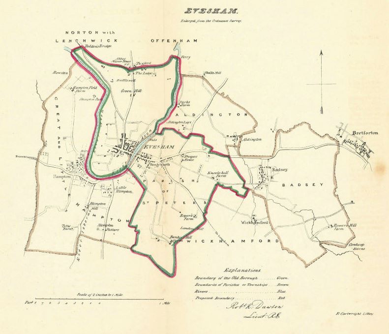
This 1832 map of Evesham is fascinating because it also shows Aldington and Badsey. By comparing with the Aldington Enclosure Map of 1807, we can see that there is now housing at Aldington Leys. Looking at the Badsey Enclosure Map of 1812, there is now a farm at Bowers Hill.
The map was published by the Boundaries’ Commission in 1832. It was drawn up by Lieutenant Robert Kearsley Dawson (1798-1861) of the Royal Engineers. Dawson had been commissioned in the Corps of Royal Engineers as 2nd Lieutenant on 1st March 1816. Between 1819 and 1829, he took part in the triangulation and mapping of Ireland and Scotland under Thomas Colby. In 1831, he was recalled to England to survey the boundaries of the proposed Parliamentary Boroughs for the Great Reform Act, producing a series of one-inch and two-inch maps that are preserved in two volumes in the British Library.