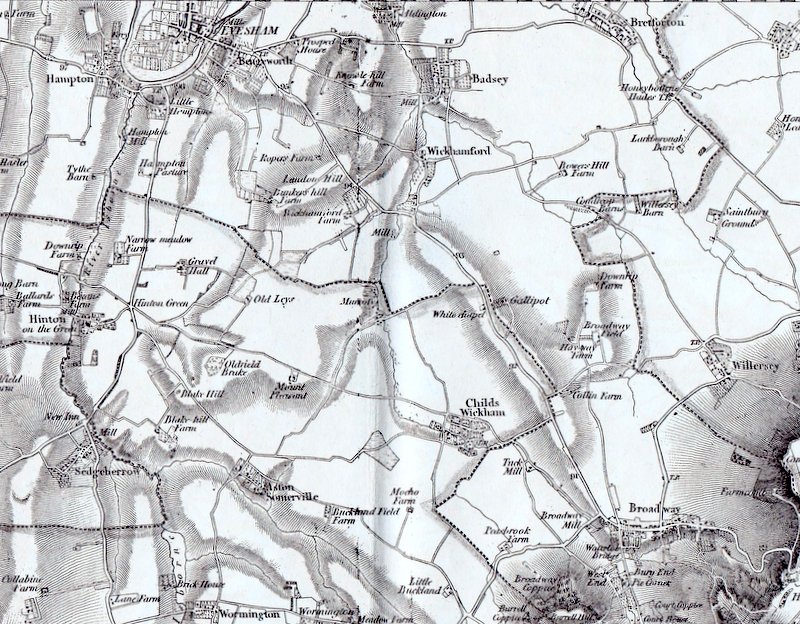
This is the local section of Ordnance Survey sheet 60 (Cheltenham). It is a reprint of the first edition of the 1" map which was produced by 'David & Charles' of Newton Abbot. The original dates from around 1863.
Note that Longdon Hill is called 'Landon Hill', Pitchers Hill is clearly marked as a ridge, but not named. What was later Field Farm was then called Wickhamford Farm. The Burnt Road/bridle path from the village street to the Willersey Road is marked as a route similar to Golden Lane and Wickhamford Lane is also a clearly marked road.