
In the Ordnance Survey map below, a number of streams in the Badsey, Aldington and Wickhamford area have been high-lighted in blue. Running from the south, from Murcot to Aldington, is the well-known Badsey Brook, which had a number of mills along its length at one time, including those in Wickhamford and Badsey. Also shown is Bullybrook, running from the east and joining Badsey Brook soon after it goes beneath the Willersey Road; a route often flooded at this point after prolonged wet weather. Two other water courses are marked. To the west is a small brook that goes under the A44 dual carriageway at Longdon Hill and then northwards to join Badsey Brook. This brook has no known name but forms the boundary between Evesham and Wickhamford parishes as it nears Badsey Brook.
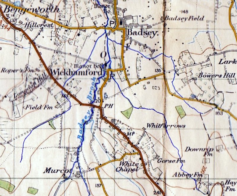
The last stream shown on the map, between Badsey Brook and Bullybrook, arises at Gorsehill Abbey Farm, just beyond the Wickhamford boundary, in Broadway parish. In flows northwards through Whitfurrows Farm, by the edge of Coombefield Plantation, under the bridle path or ‘Burnt Road’, from Manor Road, Wickhamford to ‘Frances Grave’ and the Willersey Road. It then continues behind Elm Farm, under Golden Lane into the grounds of Wickhamford Manor. It then joins Badsey Brook by the field known as ‘Long Meadow’. Along with Badsey Brook and run-off from the fields, this stream contributed to severe flooding in Wickhamford in 2007. At that time the Church, Manor, Memorial Hall and many houses along Manor Road were badly affected by the floods.
Although passing through market gardening land at Whitfurrows, the stream from Gorsehill Abbey Farm to where it joins Badsey Brook never seemed to have had a name. There is one report in The County Gentleman of January 13, 1894, of a fox hunt that took place on the 2nd of that month. The hunt met at The Swan, Bengeworth and after ‘drawing a blank’ (as it was written) at ‘Porters Plantation’ and ‘Sandy’s Arms Cover’, the pack of hounds was working its way down the ‘Wickhamford Brook’ and they got a line on a fox. They chased this towards Gallipot Farm and then Gorsehill and beyond. This was probably for most of the length of Wickhamford Brook.
In September 1898, Edmund Huxley, Charles Staite, James Staite and Frederick Brookes were summoned by Frederick Smith, of Wickhamford Manor, for fishing in ‘Wickhamford Brook’ (Evesham Standard, 3rd Sept. 1898). He stated that it was private water, which he rented along with the land it ran through. Smith had published notices in the papers and previously ordered people off of his land as he was concerned about damage to his fences. It is possible that, in this case, ‘Wickhamford Brook’ may have been a local name for Badsey Brook as it passed through the village; this was deep enough for fishing, but the stream from Gorsehill may have been too shallow for fish. From the 1894 report, at least, it is clear that the stream had a name in the late nineteenth century.
The next reference to Wickhamford Brook has not been found until after the Second World War. In about 1953, ten Council houses were constructed in a new development, Manor Close, alongside the bridle path to ‘Frances Grave’ from Manor Road. This is now to the south of Wickham Close. In February 1954 it was found that the drainage from these houses had not been carried out to an approved specification. A septic tank drainage system had been used and it was not coping with the sewage from the new houses and this was finding its way into the Brook.
In a letter reported in the Evesham Standard of 30th April 1954, and addressed to the District Council’s Health Committee, a number of residents of Manor Road complained that the Brook had become an open sewer. Amongst those signing was Joyce Sandys-Lumsdaine and Walter Batty of Wickhamford Manor, Helen and Henry Horsfield, Ruth Daffurn of Elm Farm and Norris Haines of ‘Whytebury’, Manor Road. The Tewkesbury Gazette of 1st May 1954 gave many column inches to the same subject. The debate continued for some months and ‘Wickhamford Brook’ was referred to in an article on the topic in the Evesham Standard of 23rd July that year.
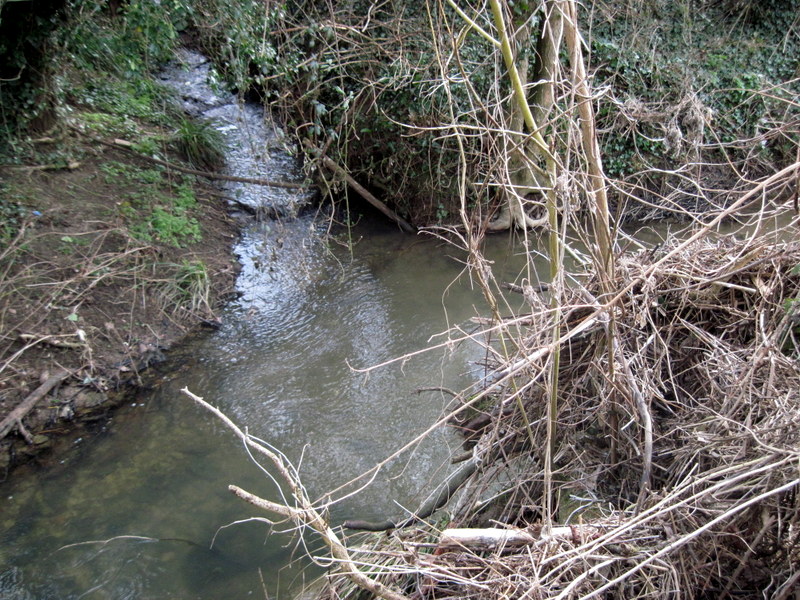
When driving or walking in the parish, Wickhamford Brook is not often visible. It can be seen in Golden Lane to the rear of Corner Cottage with a small Water Board building alongside. The Burnt Road bridle path crosses it about halfway along its route to Frances Grave. For a stretch along its length, between Coombefield Plantation and the Wickhamford/Broadway parish boundary behind Whitfurrows Farm, it forms the boundary between Badsey and Wickhamford. Wickhamford Brook is about two miles in length from its source to its junction with Badsey Brook.
Tom Locke – March 2021