
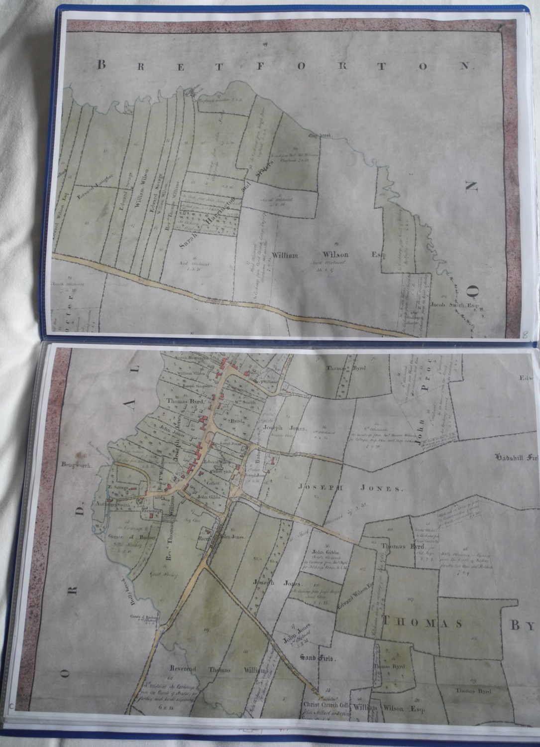
Description
Folder containing a copy of the Badsey Enclosure map in 8 sections plus copies of modern-day Ordnance Survey map annotated with numbers for use by Worcestershire Historic Environment & Archaeological Service in digitising the Enclosure Map. Aerial view of Badsey c1966 on front cover.
Year created
2006
Publication Date/Date Made
Copy made in 2006 of 1812 map
Physical Characteristics (Dimensions)
43.5 cm x 31 cm
Physical Characteristics (Description)
Blue plastic folder with A3 sheets in plastic inserts
Donor or Creator of Records
The Badsey Society
Provenance
Badsey Society records
Nature of Acquisition
Collected for the Archive
Accession Date
2006
Access Conditions
Contact Archive Manager
Reference
344/LB/MAP/E/X