
Description
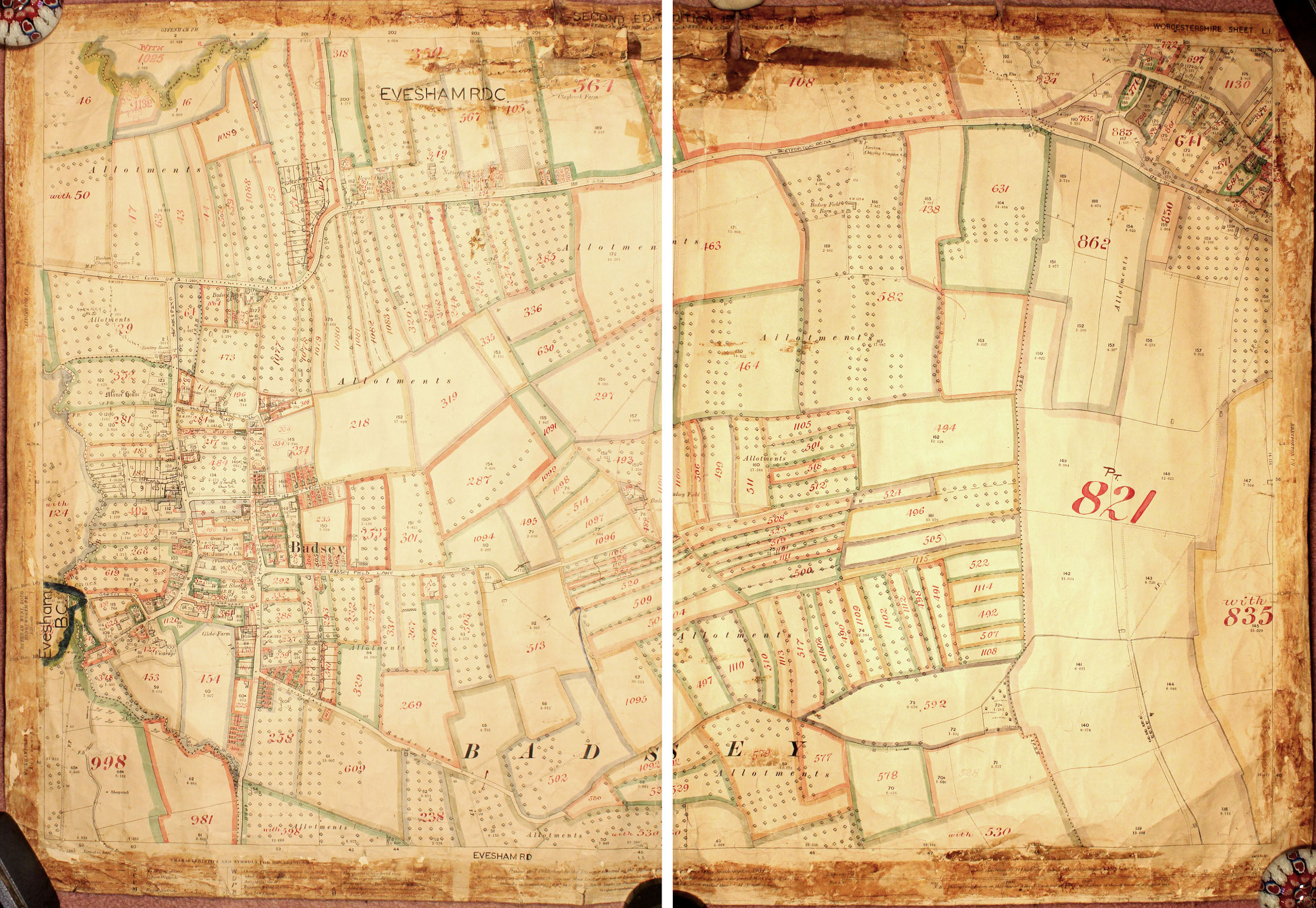
Ordnance Survey Map for Badsey with heading at top, "Second edition, 1904, Southern & Evesham Division, XLIII.13, Evesham Union, Evesham RD", and in top right-hand corner, "Worcestershire Sheet L.1". Taken from the original map of 1883, revised in 1903. Printed and published by the Director General at the Ordnance Survey Office, Southampton, 1904, price 3 shillings, scale 1:25,000. The map has been marked with coloured pens to show allotment boundaries, indicating that it was used as a working copy when a comprehensive survey of land ownership in England and Wales was undertaken between the years 1910-1915 under the Finance (1909-10) Act, 1910.
Year created
1904-1915
Publication Date/Date Made
1904-1915
Physical Characteristics (Dimensions)
102 cm x 71.5 cm
Physical Characteristics (Description)
1 sheet of parchment paper, rolled, with tears at edges - fragile
Provenance
Acquired by Terry Sparrow for the Badsey Society
Nature of Acquisition
Gift
Accession Date
2009
Access Conditions
Contact Archive Manager
Reference
368/LB/MAP/V