
Maps of the Kut Region 1916
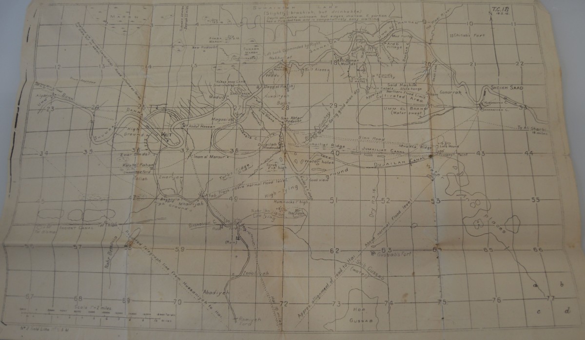
Map of the Kut-al-Amara region of Mesopotamia, dated 18th March 1916. In March 1916, the 9th Battalion of the Worcestershire Regiment arrived in Mesopotamia to assist in the campaign to relieve the British garrison at Kut which lay under siege from the Ottoman Army. The campaign resulted in a humiliating defeat with the loss of the garrison at the end of April.
On 2nd April 1917, Cyril Sladden wrote to his father with an account of the March 1916 events and included a sketch map (it is possible that the first map may have been based on this, as it is known that Cyril contributed to official histories of that campaign). His letter says: “Now that the operations around Kut are becoming ancient history, and the Turks are never likely to see that part of Mesopotamia again, I think it is possible to give you a rather more coherent idea of the general course of the fighting there, and our share in it in particular, than has been possible before. In order to do this I have drawn a sketch map of the area marking some of the chief features, and also a number of points that we were specially concerned with from time to time. In this country the only way of describing places is by a system of lettered pointed, inserted as found convenient by the map designers, and constantly increased in number. They are placed generally at intersections of trenches, mullahs and foot-tracks, and are generally very hard indeed to locate in practice.”
© The Sladden family descendants and by kind permission of the Imperial War Museum (reference 60/98/3 – Map 1) and Worcestershire Archive and Archaeology Service (reference 705:1037/9520/3/260-267 – Sketch Map 2).
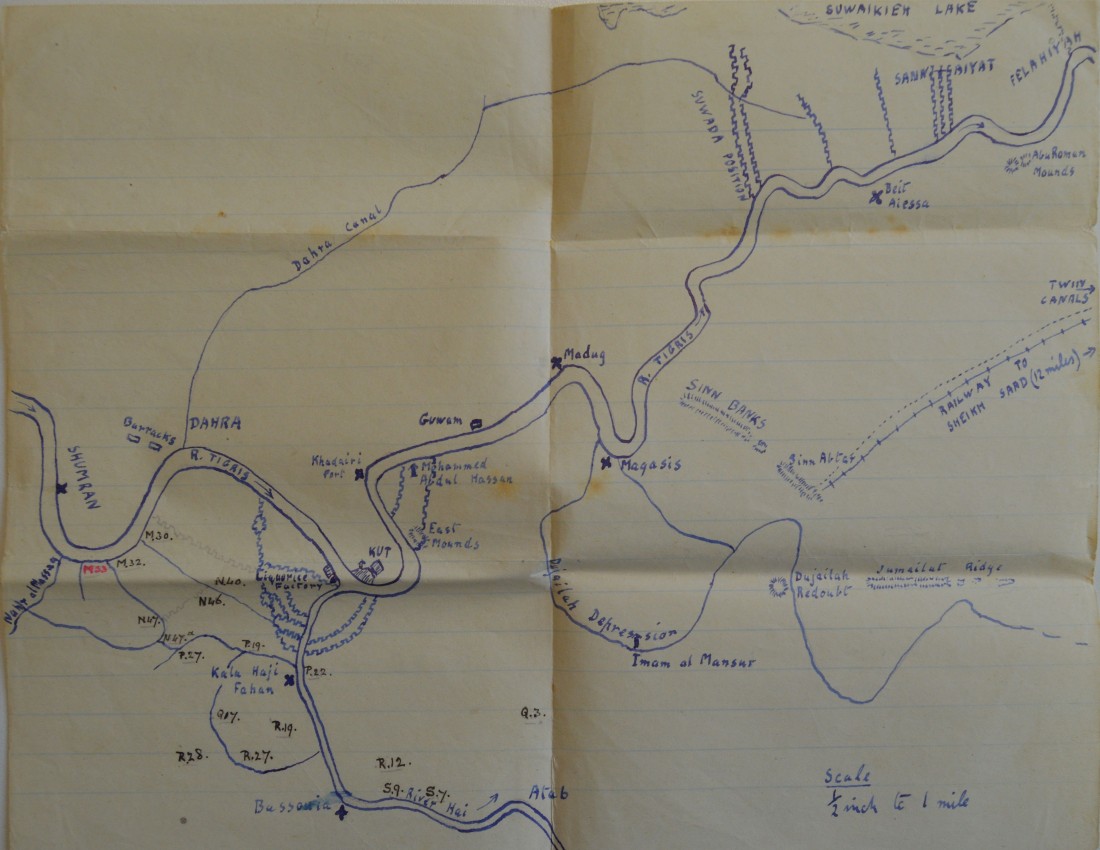
Sketch Map of Kut region