
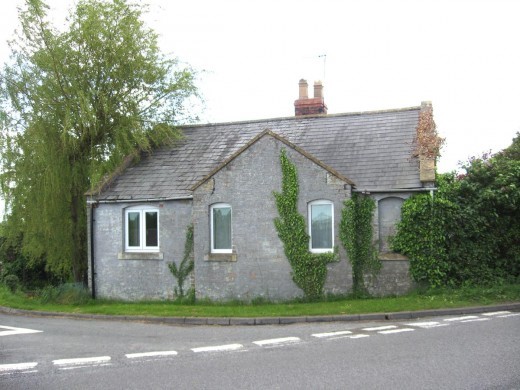
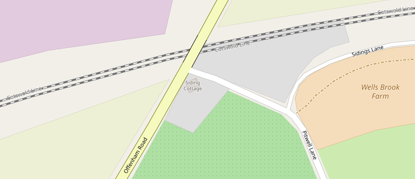
Sidings Cottage sits alone, at the junction of Offenham Road and Pitwell Lane which leads to Aldington. It was built in the mid-19th Century as a Toll House along a short stretch of Turnpike Road leading from Bengeworth towards South Littleton.
As a toll house the cottage had a very short life. The Bengeworth to South Littleton Road became a two-mile-long Turnpike in 1728, once the first Evesham Roads Act was passed by parliament. There would have been little traffic on the road and no toll house was constructed for more than 100 years as it wouldn’t have been cost effective.
We don’t have an exact record of when the toll house was built but can deduce the timing and purpose of the house from the road and railway construction around it.
The nearby Bengeworth to Badsey and Bretforton Turnpike was extended to Chipping Campden between 1822 and 1826. There would have been an opportunity to build a toll house on the Offenham Road at that time to prevent traffic bypassing the new busier road, but that did not happen. We can be sure of this for several reasons. Firstly the 1831 Ordnance Survey map shows no sign of a building whereas all other known buildings are shown. Secondly the census records list no toll house building in 1851 or earlier. Also the turnpike trust did not advertise to let the tolls on this turnpike whereas they did on all the others. And perhaps most fundamentally, the road junction on which the toll house is built did not exist until later.
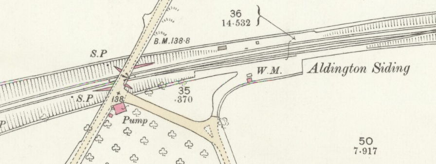
It seems the toll house is linked to the introduction of the new railway, and specifically a new siding at the top of Pitwell Lane, at what is now called Sidings Lane. The Oxford, Worcester and Wolverhampton railway was authorised by an Act of Parliament in 1845. In 1846 the location of the new line was surveyed, and construction took place over the next few years. The Evesham to Oxford line actually opened some years later, on 4th June 1853, due to a five-year delay while the problematic Campden Tunnel was constructed.
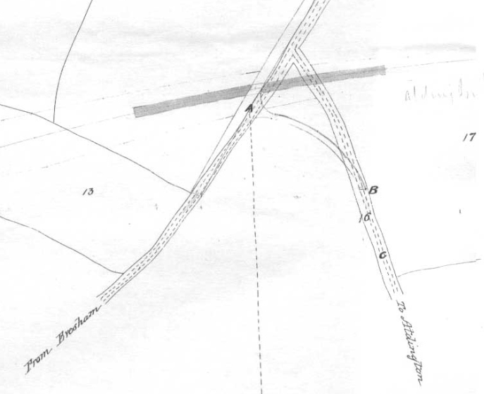
Prior to the construction of the railway, Pitwell Lane ran up straight to the Offenham Road. When the line and railway bridge were built, Pitwell Lane took a sharp kink to the left to avoid the new bridge, and it is on the new corner with Offenham Road that the toll house was built.
before the Railway.
The new section of road is shown on the 1846 surveyors map. The map does not show an existing house, even though it would only be a few feet away, leading to the conclusion that the house did not exist at that time. The house is angled to fit the shape of the junction. The house, because it is built into the embankment of the bridge, has an unusual arrangement whereby the ground floor only has windows on one side. All of these factors lead to the conclusion that the house was built after (or at the same time as) the bridge and the junction so therefore between 1847 and 1852. The March 1851 Census does not mention people living at the house so that helps to narrow the date further.
By the mid-1840s, revenue for the Evesham Turnpike Trust had already fallen considerably, due to the opening of an earlier railway line and station at Defford near Pershore. The creation of the station at Evesham, and the Aldington Sidings, probably appeared to the turnpike trustees as a good opportunity to gain back some of the revenue for market gardening produce carried between the surrounding villages and the town and siding. We don’t have any of the turnpike records that would confirm this, but it would be seem to be the best explanation for the toll house.
The only other plausible option is that the toll house was actually a ticket office for payment for goods being loaded onto the railway at the siding, though that seems unlikely.
It is probable the toll house became active as soon as the railway opened in 1853. It would have closed late in the 1860s or very early 1870s when the turnpike roads were taken into local authority control by the Evesham Highways Board. Hence it would have had an active life of less than twenty years.
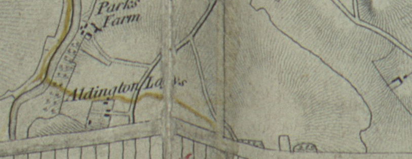
This is all confirmed by the Census records. We see no mention of the toll house on the 1851 census, but in 1861 the house was there, and occupied by Charles and Phoebe Harker, with their grandchild, Mary. Charles is shown as a Labourer and Toll Collector. The address is show as Aldington Leys Turnpike. That wasn’t the official name of the turnpike, but Aldington Leys (or Lays) was the name of an area of pasture land near the present “The Parks”. The Parks was itself originally part of the Evesham Abbey Deer Park.
In 1871 at the census the house was now occupied by Samuel and Mary Daniels with several children and grandchildren, and a lodger. Samuel is shown as a Labourer and Mary (who interestingly was born in the West Indies) was shown as a glover. In 1871 it was quite likely that the turnpike had already been taken into local authority control so a toll keeper would no longer have been required.
So to summarise, the current Sidings Cottage was a turnpike Toll House, on the Littleton Turnpike Road, for a period of less than twenty years – Probably from 1853 until around 1870.
David Ella - March 2020
Postscript
The Tollhouse was unfortunately demolished in July 2025 to make way for two new houses on the same site.